Sunday, September 30, 2007

Leaving New England

Hi All,
We are now just south of Montreal. I'll try to catch you up on what's been happening with us. We changed our plans to go south on the way home because my sister Bonnie invited us to join them in Yellowstone for a few days. So now I'm heading directly west to Montana via Quebec and Ontario. We are sorry to be leaving New England and the fall colors. It's not quite peak season for the colors, so I haven't taken any good fall color pictures yet. I hope to get some in Ontario tomorrow and maybe the next day.

Sunday, September 30, 2007
For the past few days we've been playing in and around coastal Maine: Hancock, Bangor, Ellsworth, and Schoodic Point (part of Acadia National Park). My cousin Cindy had her shop open for the weekend so we were busy getting furniture painted and ready for the sale.

Yesterday, my cousin Pete took me for a ride on his Honda motorcycle. It was a warm and sunny day. We rode out to Schoodic to watch the waves. On the way, we stopped in Winter Harbor to look at a fish packing plant and the wharf where they unload and package lobster. While we were there, hundreds of sea gulls swarmed above us and unfortunately left a couple of gifts on my cousin's motorcycle. After Pete cleaned off his motorcycle, we proceeded to the real mission -- to see the wonderful rocks and water at Schoodic Point.


On Thursday I drove up to Smyrna to visit with my cousins Dennis and Kathy. My cousin Kenny from Ohio was even there visiting, and my mother's cousin Betty came over too. We had a very pleasant time telling stories and looking at old family pictures. On the way home I saw a lovely young Moose along the highway!
This picture shows the view toward Mt. Katahdin in Baxter State Park.
Too bad the weather didn't cooperate that day. But you can see some of the fall colors, which were probably about at their peak that week.
The drive up from Bangor is a very easy drive (about 2 hours) with very little traffic. I remember driving up as a kid (before the highway was in) and it was a 12-hour trek from home in Connecticut back in those days.


Monday, September 24, 2007
We left the Markland Resort and drove along the western shore of Cape Breton. It was very windy, which made the waves pretty outstanding.


Cape Breton is a delightful place. The people are very friendly and natural. The scenery is outstanding and the roads were uncrowded (although bumpy). They had road signs like this "/\/\/\" which I discovered meant "bumpy road ahead". These signs were on most roads in Canada, and yes I checked my tires often.


The eastern side of Cape Breton is just as spectacular as the western side. We took a ride down to Smokey Mountain.

Speaking of signs, I love this sign indicating that you shouldn't ever turn your back on the ocean.


Since the weather wasn't great on the day we left Cape Breton, we drove straight through to Five Islands on the Glooscap Trail, hoping to see the tidal bore. Turns out you’d have to stand around for about 6 hours to see anything and low tide was at around 5:30, so high tide would be around midnight. But here are some pictures of the area. We camped again right on the edge overlooking the Bay of Fundy.


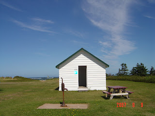
We very much enjoyed our time at the resort in Cape Breton. Here are some photos taken from the deck off my room. As you can see, you can't see another house, road, or person. It would be a great retirement job to work here during the summers. But the women who worked there didn't seem to cozy up to the idea of giving up their jobs. Roxie had the option of being on the lawn or the porch or going inside to relax in her kennel.


I meant to take photos of the showers I've encountered on this trip, but I never did it. But I can tell you they run the gamut from open-air shower (no heat) complete with spider webs, to state-of-art spa-quality bathrooms. Excuse me, in Canada, it's a 'wash room.' Now I understand why most campgrounds close in early September - they have no heat in the restrooms! I found the nicest spa-like bathrooms at some KOA's and at the upscale campground in Vermont (Smuggler's Notch). That restroom even had an indoor water fountain (like someone would want to meditate in a campground restroom).

Friday, September 21, 2007

Touring Nova Scotia and Cape Breton Highlands National Park

Friday September 21, 2007
It's been about a week since I've had real internet access. I have to chuckle at these places that claim to have internet access. The last campground had a room with a phone and I was told I'd have to have my own modem and toll-free IPS number. Chuckle. I did finally find internet access at the Gaelic College ($2.00 for as long as you want).

This morning I came up the Cabot Trail along the northwest shore of Cape Breton. Spectacular scenery. I'll post some photos from the road. And a couple of pictures from the resort I'm staying at (Markland Resort). It's very beautiful here; I could definitely stay longer than three nights. Tomorrow I plan to spend some time at a place called Meat Cove, where they say you can see the whales playing. It's just up the road and it's really at the northern end of the island.


This last photo is the beach at the resort. It's a short walk though a field of wild flowers and a small woods. Roxie had a ball chasing the waves.


Wednesday, September 19, 2007

Today was another warm sunny day, but windy at the ocean. We went through Sydney, the largest city in Cape Breton, and Glace Bay on our way to the Fortress of Louisbourg, a national historic site of Canada. The fortress has been partially restored over the past 20 years. It was originally a fortified seaport founded by the French in 1713 to protect French interests in Quebec. It was captured by the British in 1745, and then given back to France by treaty in 1748. The British changed their minds again and recaptured the fortress in 1758 and again sent the French inhabitants back to France. I’m sure the French were very tired of this after the second time. To make things worse, the British blew up the fortress in 1760, and then withdrew their troops in 1768. At any rate, the reconstructed buildings were very interesting to tour. They had thousands of historically accurate artifacts, not to mention the pigs, turkeys, and chickens in the King’s Bastion. Twice a day they have a military demonstration that includes shooting a cannon. This picture shows several of the hundreds of cannons that protected the fortress and outlying lands from the British.


The next is a view of the fortress and a typical fisherman’s house.


This is the lighthouse in Louisbourg.


Monday & Tuesday, September 17 & 18, 2007

Today we drove from Peggy’s Cove to Antigonish, stopping at Clam Beach Provincial Park for a picnic. The first two photos show the lighthouse at Peggy's Cove and the view from the lighthouse. It's said to be the most photographed of all lighthouses in Canada. You can see why. Unfortunately though, lots of people like to see it. Fortunately for me I got there early, before the crowds. On my way out I saw at least a dozen tour buses loaded with folks on their way in to see the lighthouse. I couldn't have given T@B tours to so many people.


Next day (Monday) we drove to North Sydney. Tomorrow we’ll tour the Fortress of Louisbourg historic site.


Sunday, September 16, 2007

Today at least the sun was out when I got up. We broke camp quickly and headed south and then east along highway 103 (the Lighthouse Trail). Stopped at a lighthouse that was being repaired (Baccaro Light ) and a lighthouse in a little park next to a working peer (Medway Lighthouse Park). We drove through Lunenburg and Riverport, with a stop at The Ovens Natural Area. Checked out a campsite there and it was beautiful. On a rock overlooking the ocean. But it was too remote and there were no hookups, and just an outhouse. Then we drove all the way up to Peggy’s Cove. We’re staying at a campground just outside Peggy’s Cove so we can stop there in the morning and then head up the coast. There is a place on the other side of Halifax that sounds like it would be nice to see. Then we’ll head for Cape Breton Island. I think I’ve been anxious to settle in somewhere and stop all this driving. On Friday, we go to the Markland resort at the top of Cape Breton, so we want to be within a couple of hours of there the night before (Thursday).

Saturday, September 15, 2007

Sure enough, it was raining when we woke up this morning. We left the Plantation campground as soon as we could and started driving down route 101 along the northern coast of southwest Nova Scotia. We stopped at Annapolis Royal and toured Port Royal, which is a re-creation of the oldest permanent European settlement north of St. Augustine, Florida. They slept on horsehair mattresses (if you could call them mattresses). It was very dark, rustic, and lacked any feminine influence. It appeared to house only soldiers and gentlemen. There was lots of wood to be chopped and the cannons protected them from marauding folks.
Before I could make my way to the Port Royal tour, I had to give T@B tours to an entire busload of tourists from the US. It was really pretty funny, but they had a lot of questions. Then I went downtown to Annapolis Royal to tour the Fort Anne site. I decided against doing the tour and I just walked around the grounds. I was accosted by a couple who wanted to see inside the cute little trailer. Then it started really pouring so I headed south. Drove until I found a campsite at Darling Lake. Saw three lighthouses on the way.

Friday, September 14, 2007

Touring Prince Edward Island

Friday, September 14, 2007

Yesterday we left PEI over the bridge and drove into Nova Scotia. We traveled along the southern shore of Fundy Bay and stopped overnight in Pictou. Then onto what they call the Gloosecap Trail, which follows the northern edge of Nova Scotia along Minas Basin and the Bay of Fundy. The route then becomes the Evangeline Trail. We took a side road to see the Walton Lighthouse and another side road to see Scots Bay Look off (they call them look offs rather than look outs). Here's the view from the look off. You can see the Bay of Fundy at almost high tide. On the way out of Nova Scotia, I plan to stop at a place called Five Islands where you can see the tides converge. That will be interesting.
After a long day of driving on very bumpy roads, we are exhausted and have stopped at a pretty nice campground.

The roads in all three provinces are really in bad shape. The major roads are OK, but the side sightseeing routes are full of patches, dips, and potholes. It’s sometimes difficult to even stay on the road and it’s quite dangerous driving, especially when you pass a large truck or a large camper (and there are plenty of those).

Wednesday, September 12, 2007

We drove part way up the northern coast of PEI this morning after cleaning up after a very wet and windy night. If you follow the coastal highway signs, you will see all the shoreline of the entire island. The North Cape Coastal Drive is about 300 km, the central Blue Heron Coastal Drive is about 200 km, and the easternmost loop, called Points East Coastal Drive, is about 412 km (that’s where we ran out of gas). Even though it’s not a very big island, you can sure put on the miles when you’re sightseeing. I figure I’ve put on at least 1,000 miles just on PEI while driving around the loops and doing some backtracking. So far I’ve driven almost 4,000 miles since leaving home on August 20th.

We stopped for lunch today at the West Point lighthouse. The sign said the only Canadian lighthouse with an Inn in the lighthouse. It also had a restaurant, which served up a delicious bowl of seafood chowder, including a warm biscuit with butter! The wind was blowing like crazy and they said the fishermen were coming back in because the water was too choppy. Here are a couple of pictures of the lighthouse and the angry ocean. Roxie was even afraid to go too close but she was very excited about all the stuff to smell on the beach.

After all that excitement, we decided to stay inland at Mill River Provincial Park. It’s next to the river and a lovely golf course. I’ve never seen such huge campsites and we have it almost all to ourselves. Here’s the view from the window.

The park employees are winding down for the season. They get to ride golf carts around, and right now they’re cleaning the picnic tables before storing them for the winter I suppose. Everywhere I go I’m hitting the end of the season and they’re starting to close up. I hope Nova Scotia has some parks open next week and the week after. I’d better do some research on that.

The only future reservation I have is at a resort at the northern most tip of Cape Breton. I am really looking forward to a few nights in a luxury setting with a gourmet restaurant right there. After that, there’s nowhere further north or east to go, so I’ll have to settle for returning to the mainland (New Brunswick and Maine), which is not such a bad thing after all…

Tuesday, September 11, 2007

Today started rainy and got worse as the day went on. I stopped at an internet café briefly but I couldn’t connect my laptop so I had no way to upload my pictures. Now I’ll put them on my memory stick so if I find another internet café I might be able to upload to the blogger site.

We spent the day driving along the southern part of the Points East Coastal Drive, stopping at lighthouses. Most of these are working lighthouses. The first is the Cape Bear lighthouse, which is way out on Cape Bear off a dirt road. It was built in 1881 and moved back from eroding cliffs in 1947.

The second is the Wood Islands lighthouse, which is situated in a small park on the Northumberland Strait. From the lighthouse you can see the Wood Islands ferry, which goes to Nova Scotia several times a day. It costs $80 for a vehicle between 30 and 40 feet. The Confederation Bridge costs $40 plus $6.75 for each extra axel, but you only pay when you leave. It’s free to come into PEI on the bridge, buts it costs to leave.

The next lighthouse was on Point Prim. It’s one of the few brick lighthouses in Canada; it’s now covered with wooden shingles and painted white.

Then we decided to head to the North Cape area so we can follow the North Cape Coastal Drive tomorrow. It promises to be a mixed day with both sun and rain. We found a campground that claimed to have internet but when I asked about it, the woman pointed to the phone outside (in the rain). They also claimed to have cable TV, which sort of worked. After spending about an hour trying different cables, I finally got a fuzzy picture of a few channels, but with the wind and pouring rain outside, we were quite pleased to have it.


Monday, September 10, 2007

We ran out of gas at East Point, PEI this morning. I took the northern route across King’s County PEI and even passed an Irving station on the way. But I thought, there are lots of little towns between here and the end of the island so I’ll stop for gas somewhere on the way. And there were lots of little towns, but none of them had gas. They just had a sign saying the name of their town but no town to speak of. Some were just a scattering of houses. And suddenly there would be a large church in the middle of nowhere, but no town center. I pressed the pedal to the metal hoping there would be gas somewhere along the way, planning my long walk to the nearest ‘town’ and wondering whether it would be better to backtrack or go forward, for who knew what lay ahead? I coasted into East Point, the real eastern point of PEI. It had a lighthouse and a gift shop, but sadly, no gas. I was surely running on fumes as my gas meter reading said ---- miles left and the gauge was well below empty. Here’s a picture of the East Point lighthouse.

I talked with the woman (Nancy) who managed the lighthouse and she called a friend who would be happy to bring a few liters of gas for 20 bucks. While we waited for her friend to arrive, we chatted about the island and how she got there. She was originally from Chicago and then moved to Toronto where she owned a high-tech marketing company, and finally moved to PEI. She said she knew she had to live there from the moment she set foot on the island. It does affect you that way, with its beauty and quiet. Her friend was a slight Frenchman who used to be a race car driver. He arrived in his rusty old Volvo station wagon with a huge dog in the back. He poured a couple of liters of gas into my tank and then jovially agreed to follow me to Wilson’s (a gas station) which he said was about 6 km away. At the gas station, he told me to always keep a full tank of gas on the island because you never know where you might find a gas station on the far extremes of the island, and I will take his advice seriously.

I had planned to go south to Brudenell Beach but Nancy pointed out that Red Point Provincial Park had a beautiful beach. So here I am, camped right on the beach. Nothing between Tabette and the ocean, except for a cliff of red earth and 33 stair steps to the beach below. We spent a wonderful afternoon walking on the beach and sitting above the beach looking for seals and whales with my binoculars. There is almost no one else here, and they close the park for the season in just a few days. We feel very fortunate to have almost run out of gas, so that we met the lady in the lighthouse who told us about this wonderful campground on the ocean.

This is the first time Roxie has been able to walk on the beach. After a few times trying to bite the waves, she gave it up and just ran into them for the pleasure of it. She thought there were lots of new and interesting smells on the beach too.


Before leaving "Anne's Land" I wanted to show you a couple of pictures of the landscape here. The farms go right to the edge of the ocean. Here's a picture from a viewpoint looking north.

And no, they're not huge white worms, but just those same rolled haybails wrapped in white plastic. Apparently they have a machine that wraps the rolled bails and it looks like they leave them in the fields for the winter. Come to think of it I haven't seen a whole lot of hay barns on the island.

Tuesday, September 11, 2007

Cardigan PEI

Hi All,
I just stopped at an internet cafe for the first time but unfortunately I can't upload pictures. It's a rainy day so I'm traveling south along the shore of King's County.The island is divided into three counties: you guessed it - Prince, Queen, and King counties.
They predict sunny days tomorrow and Thursday so I hope to get set up somewhere on the shore so I can enjoy the sun.
Hope you are all well and thanks for all your comments. It's really fun to read them and helps me not feel so far from home.

Monday, September 10, 2007

Anne's Land on Prince Edward Island

We’re staying at a nice large campground called ‘Vacationland Campground.’ Here’s the view from inside my screen room looking toward the Brackley River.
Here's another shot of Roxie enjoying herself at the camp site.

On Saturday we took a walk along the boardwalk outside Cavendish. It was a beautiful day with just a light breeze. These people have it made here on this island.


We toured ‘Anne’s Land’ farm and drove along the coastal highway to Malpeque. I wanted to see Cabot Beach but didn’t find the turn off. Hopefully I’ll see that on the last leg of the tour (North Cape Coastal Drive). We toured the house that Lucy Maud Montgomery wrote about in her stories "Anne of Green Gables."


We went out for a drive on Sunday. It was another beautiful drive first to Brackley Beach and then to Dalvay and Stanhope beaches in PEI National Park. The beaches are unspoiled and it’s like stepping back into time. The Stanhope Beach parking lot might hold 15 or 20 cars. There was a very plain changing house; one side for men and one for women. Look at the sign showing a woman’s silhouette with a clothes hanger. There was also a separate bathhouse and a two-seater outhouse. Very quaint.
At an access point near Stanhope Beach, I talked briefly with a woman who was dragging her wind sail up from the beach. She said she learned to wind sail when she spent a year in a camper van on the west coast. She’s an elementary art teacher and her husband just retired. She said all their friends were retiring but she had a few more years to work, being younger than her husband. She said she lived for a few months in Colorado and New Mexico and she loved those states; the only places where she didn’t yearn for the smell of the sea air. She also said she lived for a few years in Ontario for love; that is where her husband is from. She says she has an old farmhouse on PEI and comes for the weekends. She lives and works in Halifax NS. It was very interesting to see her having such fun wind surfing in what she called a very ‘friendly’ ocean.


We drove up Route 6 and then to Route 2, which took us along the coast on East Coastal Drive. Everywhere I looked was beautiful and picturesque. The entire province that I’ve seen so far has been pastoral, neat, uncluttered, green, and very well cared for.

We decided tomorrow that we would head for the campground at Brudenell River Provincial Park. Then spend the day touring the northern loop and the next day touring the southern loop. After that we’ll explore the North Cape and then on to Nova Scotia. It should be around Friday or Saturday by that time.